If you love the idea of a Stonington waterfront parcel but feel unsure about tides, moorings, and what it means for daily access, you are not alone. Tidal range, bottom type, and working-harbor rhythms all shape how you use the shore. This guide shows you how to evaluate depth, access, permitting, and long-term risk so you can buy with confidence. Let’s dive in.
Why tidal access matters in 04681
Tidal range controls how much shoreline is exposed at low water and how much depth you have at a float or mooring. Bottom type and local bathymetry determine whether a private mooring will hold and how you approach it safely. Shore structures, permits, and title language affect your legal right to build or maintain access. In a busy working harbor, daily fishing activity, gear, and traffic also shape use and value.
Read the tides with confidence
Know your datums
Get familiar with a few key terms. Mean Lower Low Water (MLLW) is the chart datum used on nautical charts and is the reference for depths. Mean High Water (MHW) and Mean Higher High Water (MHHW) help you understand where the ordinary high-water mark sits, which matters for access and dock placement. NAVD88 is the common land-based vertical datum used for surveys and FEMA elevations.
Get the right numbers
Use the nearest NOAA Tides and Currents station for tide predictions and local datum conversions. Ask the harbormaster if there are local variations recorded in town tide tables or harbor logs. Look beyond the average range and note spring and neap tide differences, along with seasonal shifts.
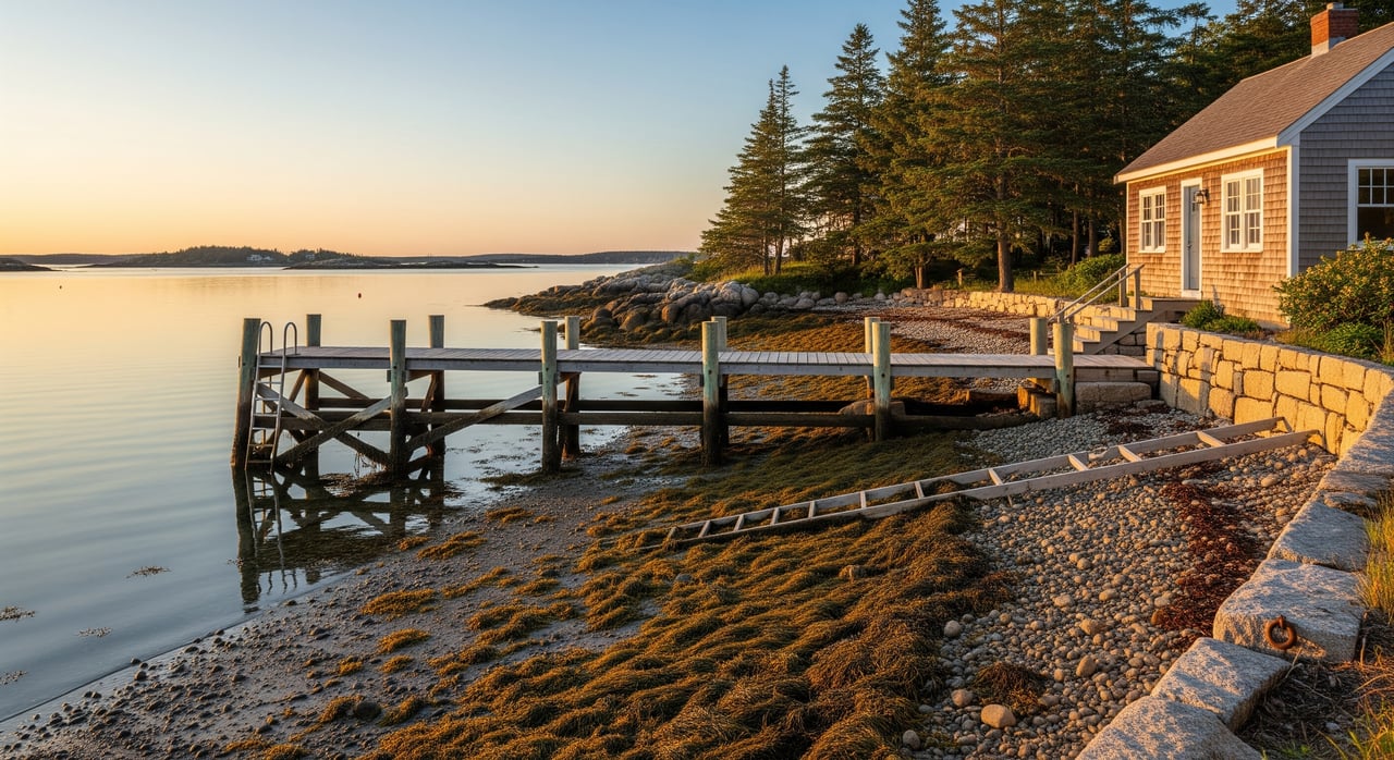
What to look for on site
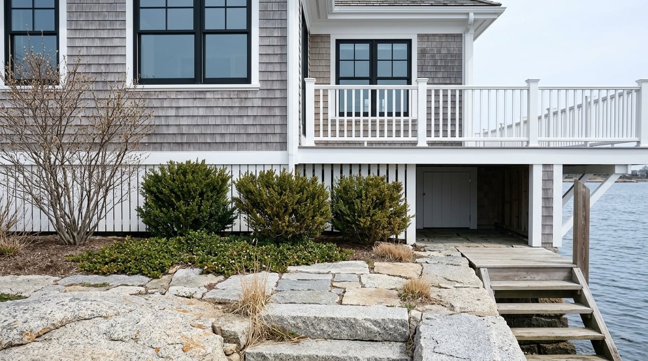
Visit at both high and low tide to see how much shore is exposed and where a ramp or stairs land. Check the elevation of proposed structures relative to MHW and MHHW to avoid frequent tidal flooding. Measure usable depth at the likely mooring or float location at low water and note any ledge or mudflat.
Test mooring potential off your shore
Depth at low water
A safe mooring needs enough depth at low tide for your vessel’s draft plus clearance for surge and motion. Confirm depths relative to MLLW where you would place the mooring and along the approach. If needed, commission a small-scale bathymetric check with an echo sounder or a marine contractor.
Bottom type and gear
Bottom composition affects holding power and the type of anchor used. Mud often suits mushroom anchors, sand may call for screw anchors or heavy blocks, and ledge can require drilled anchors or pilings. Ask for any prior mooring records or contractor notes that describe bottom conditions.
Swing room and exposure
Calculate swing radius based on boat length and chain length, plus a safety buffer. Consider wind and wave exposure from open fetch versus a sheltered cove. Keep clear of marked channels, common traffic routes, and hazards.
Practical checks and measurements
Review mooring field maps or placement records with the harbormaster. Identify typical vessel sizes in the harbor and match your gear accordingly. Ask about winter ice and thaw, which can affect floats and mooring hardware in Maine.
Shore access, structures, and title
Ownership and boundaries
Deeds vary on where a waterfront boundary lies, such as to the mean high-water line or to a low-water mark. Verify deed language and survey references to NAVD88, MHW, or MLLW during due diligence. Confirm any easements or rights-of-way for shared shore access or dinghy routes.
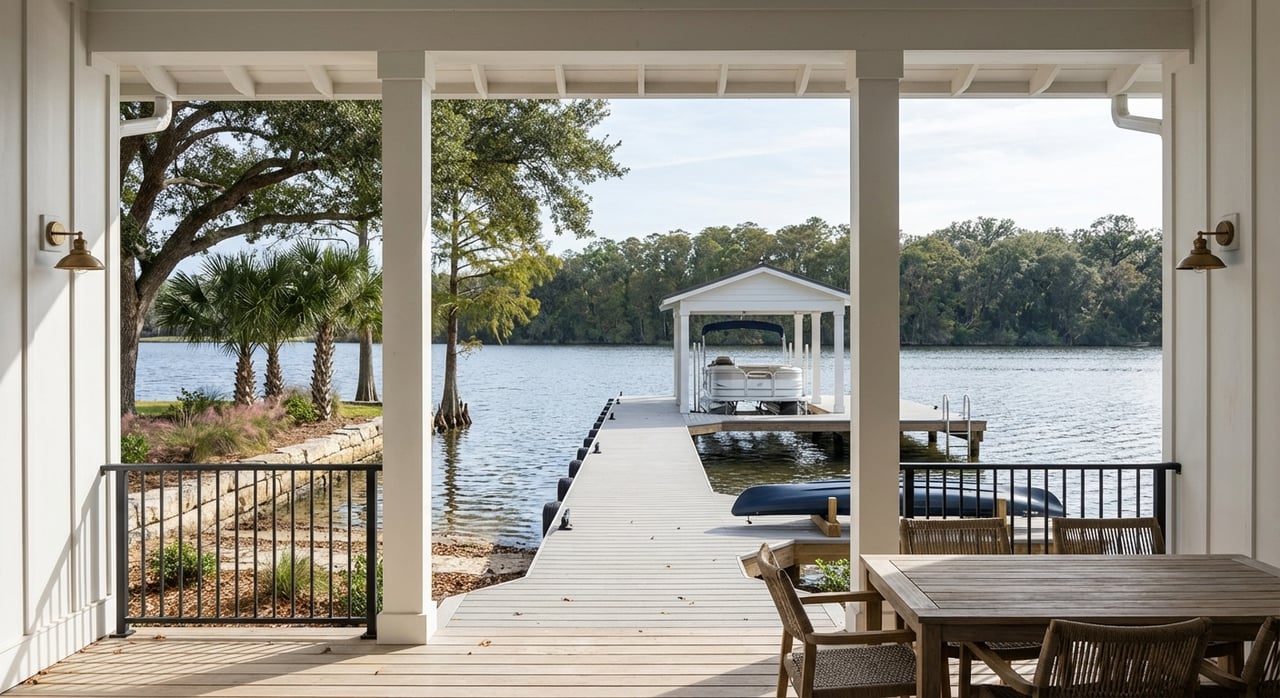
Existing infrastructure
Inspect docks, floats, ramps, stairs, and any shoreline stabilization for condition and visible permit details. Clarify who owns, maintains, and insures each element. Note onshore utilities and nearby services that support boating activities.
Permits and authorities
Plan for municipal mooring rules and local harbor oversight. State-level review often involves the Maine Department of Environmental Protection for shoreline structures and the Maine Department of Marine Resources for shellfish and aquaculture considerations. Federal jurisdiction from the U.S. Army Corps of Engineers may apply to structures in navigable waters, and local shoreland zoning and FEMA designations guide siting and elevations.
What to verify in documents
Request recorded permits for any existing shore structures and confirm there are no outstanding violations. Check for conservation restrictions or shoreland zoning setbacks. Keep copies of any past surveys that reference both tidal and land datums.
Working harbor realities in Stonington
Stonington is an active working harbor, with lobster and fishing fleets that move gear and product on daily and seasonal schedules. Expect early-morning activity, gear in the water, and increased summer traffic from recreational boats and visitors. Some buyers value the authenticity and vibrancy, while others prefer quieter coves. Mooring placement and dock use can be limited by commercial priorities near municipal wharves, so plan accordingly.
Plan for flood risk and sea-level rise
Use FEMA Flood Insurance Rate Maps to identify flood zones and base flood elevations. Compare structure and grade elevations in NAVD88 to those BFEs to understand risk and potential insurance requirements. Review sea-level rise projections and local guidance to plan for adaptation over a 20 to 50-year ownership horizon.
Map it like a pro
Authoritative tools can simplify your analysis. NOAA provides tidal predictions, datum conversions, and electronic navigational charts with bathymetry. FEMA’s Flood Map Service Center shows flood zones and BFEs. State resources include the Maine Office of GIS for parcels and shoreland layers, the Maine Geological Survey for coastal change guidance, and the Maine Department of Marine Resources for shellfish and aquaculture maps.
Combine layers for a clear picture
Overlay parcel boundaries on NOAA bathymetry to visualize depth at low tide near your shore. Add FEMA flood zones and NAVD88 contours to compare tidal datums with flood risk. Check DMR layers for shellfish beds or aquaculture leases that might limit pier or dredging options.
Validate in the field
Walk the shore at spring low tide to see maximum exposure and at spring high tide for maximum inundation. Approach by boat at different tide states to confirm draft limits and maneuvering space. Note any shoaling, obstructions, or hazards noted by the harbormaster.
Buyer checklist for 04681 parcels
- On-site
- Visit at both low and high tide to evaluate access and exposure.
- Measure depth at proposed tie-up points at low water.
- Inspect docks, piles, and floats for condition and submerged hazards.
- Observe working-harbor activity at different times and seasons.
- Documents
- Request surveys, deed language, and any easements or access agreements.
- Gather permits and maintenance records for all shore structures and moorings.
- Confirm shoreland zoning, conservation restrictions, and any compliance history.
- Professionals
- Engage a licensed marine contractor or surveyor for bathymetry and structural checks.
- Consult a coastal engineer for complex shoreline conditions.
- Retain a real estate attorney experienced in Maine coastal property for title and access questions.
- Speak with the harbormaster and harbor committee about rules and availability.
- Approvals
- Verify local mooring permits and eligibility for placement.
- Confirm municipal approvals for floats, ramps, and stairs.
- Check potential Maine DEP, DMR, and USACE requirements for new structures.
Smart questions to ask
Seller or listing agent
- Have there been surveys that reference NAVD88, MHW, or MLLW along this shoreline? Can you share them?
- Are there recorded public or private easements for shore or dinghy access? Any shared-use agreements?
- What shore structures exist, who owns them, and are they fully permitted?
- Any recent repairs, replacements, or enforcement actions?
- Are there records of typical low-water depths off the property?
- Have you experienced erosion, ice damage, or storm overwash?
Harbormaster and harbor committee
- Where are permitted mooring fields relative to the parcel, and can a private mooring be placed here?
- What is the process and wait time for a new mooring permit?
- Are there seasonal restrictions or commercial zones that affect private moorings?
- Any known shoaling, dredging plans, or navigational hazards nearby?
- Are there rules for anchor and chain lengths, swing diameters, or restricted areas?
- How frequently do commercial vessels use this immediate area, and where is gear staged?
Municipal and state officials
- What shoreland zoning or setback rules apply to new structures here?
- Do conservation or shellfish protections affect pier placement or dredging?
- What are the FEMA flood zones and BFEs for the parcel? Are elevation certificates available?
- Are aquaculture leases or conservation overlays nearby?
What this means for your purchase
When you combine accurate tidal data, bottom conditions, clear title, and a realistic view of Stonington’s working harbor, you make a smarter waterfront investment. A structured evaluation protects your daily use today and your property value over time. If you want a steady, high-touch partner to help you weigh options and coordinate the right local experts, connect with Laura Farr.
FAQs
How do tides affect daily boat access in Stonington?
- Tidal range determines how much water you have at your float or mooring at low tide and where ramps and stairs land at high tide, so you should measure low-water depth and check spring versus neap conditions before committing.
What permits are needed for a private dock in Hancock County?
- Expect local approvals plus possible state review by the Maine Department of Environmental Protection, coordination with the Maine Department of Marine Resources, and potential U.S. Army Corps of Engineers involvement for structures in navigable waters.
Can I place a private mooring off my Stonington property?
- That depends on harbor rules, available space, and site conditions; confirm with the harbormaster, verify depth at mean low water, and match the anchor type to the bottom.
How do I check flood risk for a waterfront home in 04681?
- Use FEMA Flood Insurance Rate Maps to find flood zones and base flood elevations, then compare those BFEs to your structure elevations in NAVD88 and consider insurance needs.
How does working-harbor activity impact property use?
- Commercial fishing, gear in the water, and seasonal traffic can affect noise, early-morning activity, and mooring or dock placement, so observe the area at different times and discuss priorities with the harbormaster.
How can I assess bottom type without a full survey?
- Review prior mooring or contractor records if available, check NOAA charts for general clues, and conduct on-site probing or a targeted echo sounder pass with a marine contractor to confirm holding conditions.