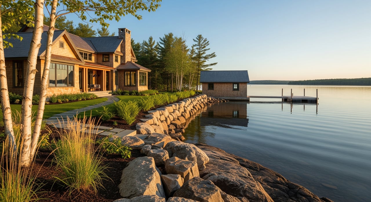
You find the perfect cabin on a mirrored Aroostook lake, and your mind jumps to docks, additions, and summer evenings by the water. Then shoreland zoning pops up and everything suddenly feels complicated. You are not alone. These rules protect Maine’s waters, and they also shape what you can build, remove, or replace on a waterfront lot.
In this guide, you will learn what shoreland zoning is, how it works in Aroostook County, and what to check before you buy. You will get a practical checklist, plain‑English definitions, and clear next steps to keep your plans on track. Let’s dive in.
Shoreland zoning basics
Shoreland zoning is Maine’s system for regulating development near lakes, rivers, streams, and coastal areas. It exists to protect water quality, habitat, and public use. The state sets minimum standards. Each municipality adopts its own ordinance that meets or exceeds those standards. In unorganized townships and plantations across Aroostook County, the Maine Land Use Planning Commission (LUPC) applies and enforces the rules.
Why it matters to you: shoreland zoning affects where a home can sit, how big an addition can be, whether a dock or boathouse is allowed, what vegetation you can remove, how much impervious surface you can add, and where a septic system can go. It also drives permit needs, timelines, and costs.
What counts as the shoreland zone
The shoreland zone is a defined area around water. Many Maine ordinances regulate land within roughly 250 feet of the normal high‑water line of lakes and great ponds, rivers, and coastal wetlands. Smaller streams can have narrower protected areas, such as 75 feet. Because distances and definitions vary, verify the exact zone for each property in the local ordinance or with LUPC if the parcel sits in unorganized territory.
A common term you will see is “great pond,” which often means ponds or lakes above a set acreage. Rules for great ponds can differ from smaller waterbodies, so ask which category applies to the property you are considering.
Key terms you will hear
- Normal high‑water line: The mark on the shore where water levels usually reach, which is used to measure setbacks. A surveyor can help identify it.
- Nonconforming structure: A building that was legal when built but does not meet today’s standards, such as setback distance. Special rules apply if you plan to expand or rebuild it.
- Vegetative buffer: A strip of natural plants and trees near the shoreline that must be preserved to protect the water. Some clearing is limited or requires replanting.
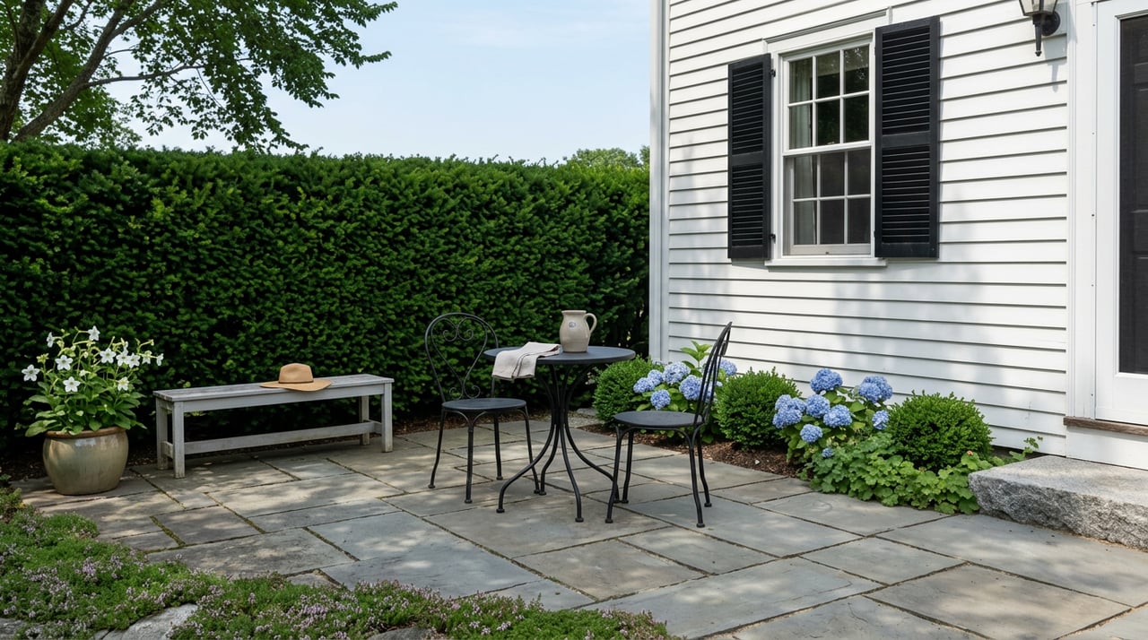
Setbacks and building location
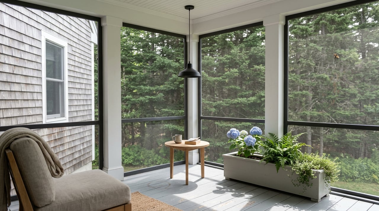
Most ordinances require new primary structures to be set back from the normal high‑water line. Accessory structures, like sheds or non‑habitable boathouses, may be allowed closer to the water with size limits and special standards. Exact distances and reduction options are local. Before you draft any plans, confirm the setback for the specific shoreland district and waterbody.
If a current home sits closer to the water than today’s rules allow, it may be legal but nonconforming. Replacing it in the same footprint is often possible, while expansions or relocations usually trigger approvals or variances.
Vegetation and buffers
Expect rules that keep a vegetated buffer along the shore. Many ordinances limit tree removal and understory clearing within this zone. Some require a point‑based or percentage approach to thinning, and many require replanting if you remove vegetation beyond allowed maintenance. These standards are designed to reduce erosion and protect water quality.
Impervious surface and lot coverage
Roof areas, paved drives, and patios can be limited within the shoreland zone. Municipal ordinances often cap impervious surface as a percentage of the lot or the waterfront setback area. This can affect how large an addition, garage, or hardscape you can add. Ask for the exact coverage limit for the property and plan your project around it.
Septic systems and wastewater
Septic location and design are governed by state subsurface wastewater rules and local plumbing permits. On narrow or small lots, meeting separation distances can be challenging. If you will need a new or replacement system, talk with the local code officer or LUPC early and consider consulting a septic designer to confirm feasibility.
Docks, piers, and boathouses
Dock and pier rules depend on the waterbody type and local shoreland standards. Many freshwater docks are allowed with local permits. Tidal projects, wetlands, and navigable waters can involve additional state or federal reviews. Boathouses often have special size and use limits, and habitable space is frequently restricted. Ask about permits, navigation concerns, and public access issues before you assume a design will work.
Shoreline stabilization
Hard armoring such as riprap or seawalls usually needs permits because it can affect habitat and downstream properties. Regulators often prefer softer, vegetative methods when possible. If the shoreline is eroding, get expert advice and be ready for a longer review process.
Nonconforming structures and replacements
Many waterfront homes in Maine are nonconforming by today’s setbacks. If you plan to rebuild, most ordinances allow replacement within the same footprint. Expansions or relocations are more complex and may require special approvals or a variance. Rules differ on what is allowed after damage from storms or other events, so ask about the specific scenario you might face.
Who issues permits in Aroostook
- Organized municipalities: The code enforcement officer, planning board, and local appeals board manage shoreland permits and enforcement.
- Unorganized territories and plantations: LUPC administers shoreland standards. This is common across large parts of Aroostook County.
- State and federal layers: Some projects involve Maine DEP or, for certain waters, federal agencies. Coastal or tidal work can take longer due to interagency reviews.
Permits, timelines, and inspections
Common permit triggers include new homes, additions, decks and garages, docks and floats, shoreline stabilization, vegetation removal beyond basic maintenance, lot changes, and any septic work. A simple permit might be approved in a few weeks. Projects that need board review, site visits, or state and federal sign‑offs can take months, especially near tidal waters.
Expect to provide site plans showing setbacks and lot coverage, vegetation or tree plans, erosion‑control details, and sometimes a professional survey. Permit approvals often include inspections during and after construction. Working without permits can lead to stop‑work orders, fines, and required restoration.
Due‑diligence checklist for buyers
Use this short list before you write an offer and during your due diligence period:
- Confirm jurisdiction: Is the property in an organized town or under LUPC? Call the town office or the LUPC district office.
- Ask for a survey: Look for the normal high‑water line and building footprints on a current plan.
- Get the ordinance: Request the town’s shoreland zoning district map and ordinance text, or LUPC standards for the parcel.
- Review permits: Ask for any past or current shoreland permits, variances, or enforcement notices.
- Check septic: Request inspection reports, as‑builts, and maintenance records. Note any replacement plans.
- Verify flood info: Obtain elevation and flood zone maps if the parcel is in a floodplain.
- Docks and boathouses: If present, request permits and maintenance records. If not, ask about feasibility and permit triggers.
- Ask officials: Confirm setbacks, buffer requirements, lot coverage limits, nonconforming status, and typical timelines for your planned projects.
- Site photos: Review recent images of the shoreline, vegetation, and structures.
Planning docks and shoreline projects
If a dock or boathouse is on your wish list, start the conversation early. Rules vary by waterbody and jurisdiction. Ask whether the water is classified as a great pond, whether navigation or public access affects design, and whether any state or federal permits might be needed. Build time in your schedule for reviews and seasonal restrictions.
When to hire specialists
- Surveyor: To confirm the high‑water line, lot lines, and setbacks.
- Septic designer/engineer: To evaluate replacement or upgrades on tight lots.
- Wetland scientist or coastal engineer: For shoreline stabilization or complex permits.
- Local land‑use attorney: For variances or detailed nonconforming questions.
Common pitfalls and enforcement
Unpermitted work or vegetation clearing can lead to fines, restoration orders, and delays. Docks without proper approvals can be flagged during resale. Keep a clean paper trail. Ask the code officer or LUPC about any past complaints or conditional approvals tied to the property.
Resale and financing implications
Open violations or unpermitted structures can slow or block mortgage approvals and title insurance. Lenders and title companies often require proof of compliance before closing. Doing your homework now protects your project and your future resale.
How to approach your first call
When you speak with a town code officer or LUPC staff member, be specific and concise:
- Provide the property address, map/lot, and whether it is on a lake, river, or stream.
- Ask which shoreland district applies and for the exact setbacks, buffer, and coverage limits.
- Describe your plan in simple terms: rebuild in place, add a bedroom, install a dock, replace septic.
- Request timelines, required materials, and whether a board review is likely.
Clear questions lead to clearer answers, and they help you budget time and cost more accurately.
Ready to explore Aroostook County waterfront with confidence? For tailored guidance and a calm, steady process from search to closing, connect with Laura Farr.
FAQs
What is Maine’s shoreland zone and why does it matter?
- It is a regulated area around waterbodies where development, vegetation removal, and lot coverage are controlled to protect water quality, habitat, and public use.
Who regulates shoreland rules in Aroostook County’s unorganized townships?
- The Maine Land Use Planning Commission (LUPC) administers and enforces shoreland standards in unorganized territories and plantations.
Can I expand a camp that sits close to the water?
- Many such camps are legal nonconforming; replacement in the same footprint is often allowed, but expansions or relocations typically need special approvals or a variance.
Are docks allowed on Aroostook lakes?
- Many freshwater docks are possible with local permits, but details depend on the waterbody and jurisdiction, and some projects can trigger state or federal reviews.
How long do shoreland permits take in Maine?
- Simple permits may be approved within weeks, while projects needing board review or interagency coordination can take several months, especially for shoreline or tidal work.